

Jeju Island
Jeju Island is South Korea's largest island, covering an area of 1,833.2 km, which is 1.83 percent of the total area of the country. It is also the most populous island in South Korea; in 2020, the resident registration population is about 670,000. The island is its own province (Jeju Special Self-Governing Province).
At the end of September 2020, the total resident registration population of Jeju Special Self-Governing Province is 672,948, of which 4,000 reside on outlying islands such as the Chuja Islands and Udo Island.
The island lies in the Korea Strait, south of the Korean Peninsula, and South Jeolla Province. It is located 82.8 km off the nearest point on the peninsula. Jeju is the only self-governing province in South Korea, meaning that the province is run by local inhabitants instead of politicians from the mainland.
Jeju Island has an oval shape of 73 km east–west and 31 km north–south, with a gentle slope around Mt. Halla in the center. The length of the main road is 181 km and the coastline is 258 km.
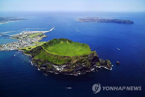
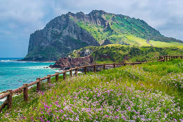
The northern end of Jeju Island is Kimnyeong Beach, the southern end is Songak Mountain, the western end is Suwolbong, and the eastern end is Seongsan Ilchulbong.
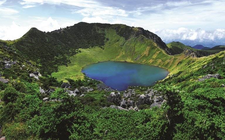
The island was "formed by the eruption of an underwater volcano approximately 2 million years ago". It contains a natural World Heritage Site, the Jeju Volcanic Island and Lava Tubes. Jeju Island has a temperate climate which is moderate; even in winter, the temperature rarely falls below 0 °C (32 °F). Jeju is a popular holiday destination and a sizable portion of the economy relies on tourism and related economic activity.